A custom-built ArcToolbox tool for estimating gas flux footprints directly within ArcMap.
arcgispythontrace gases
A pilot study (no pun intended) of an airborne instrument for estimating carbon dioxide flux in cities.
trace gasespythonruav
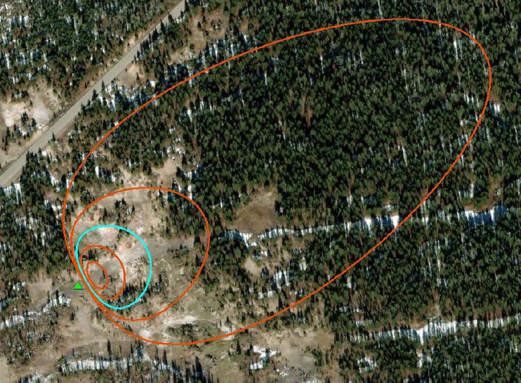
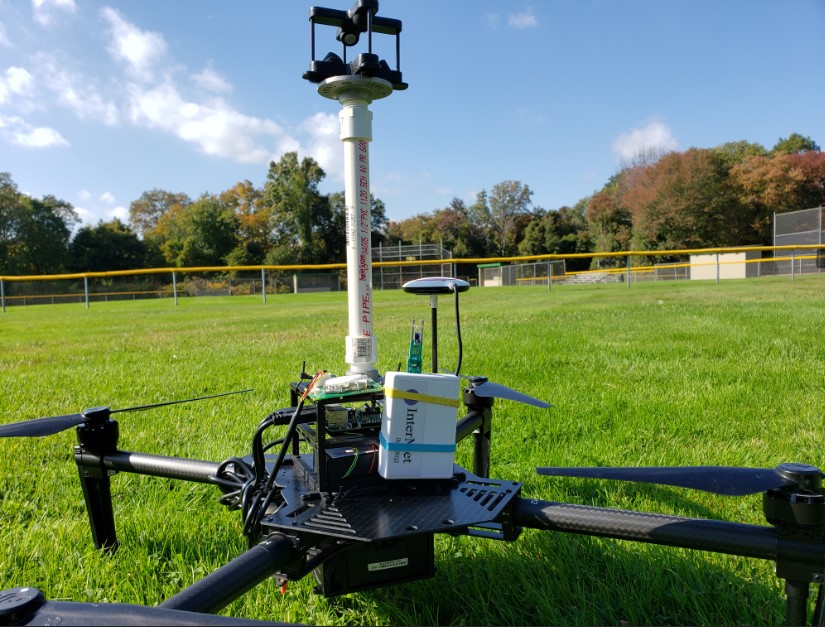
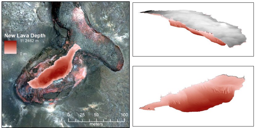
Using drone imagery collected during the 2018 Kilauea eruption, I built a 3D model of a volcanic fissure and quantified changes in the fissure's morphology and volume.
agisoft photoscandata analysisremote sensinguav
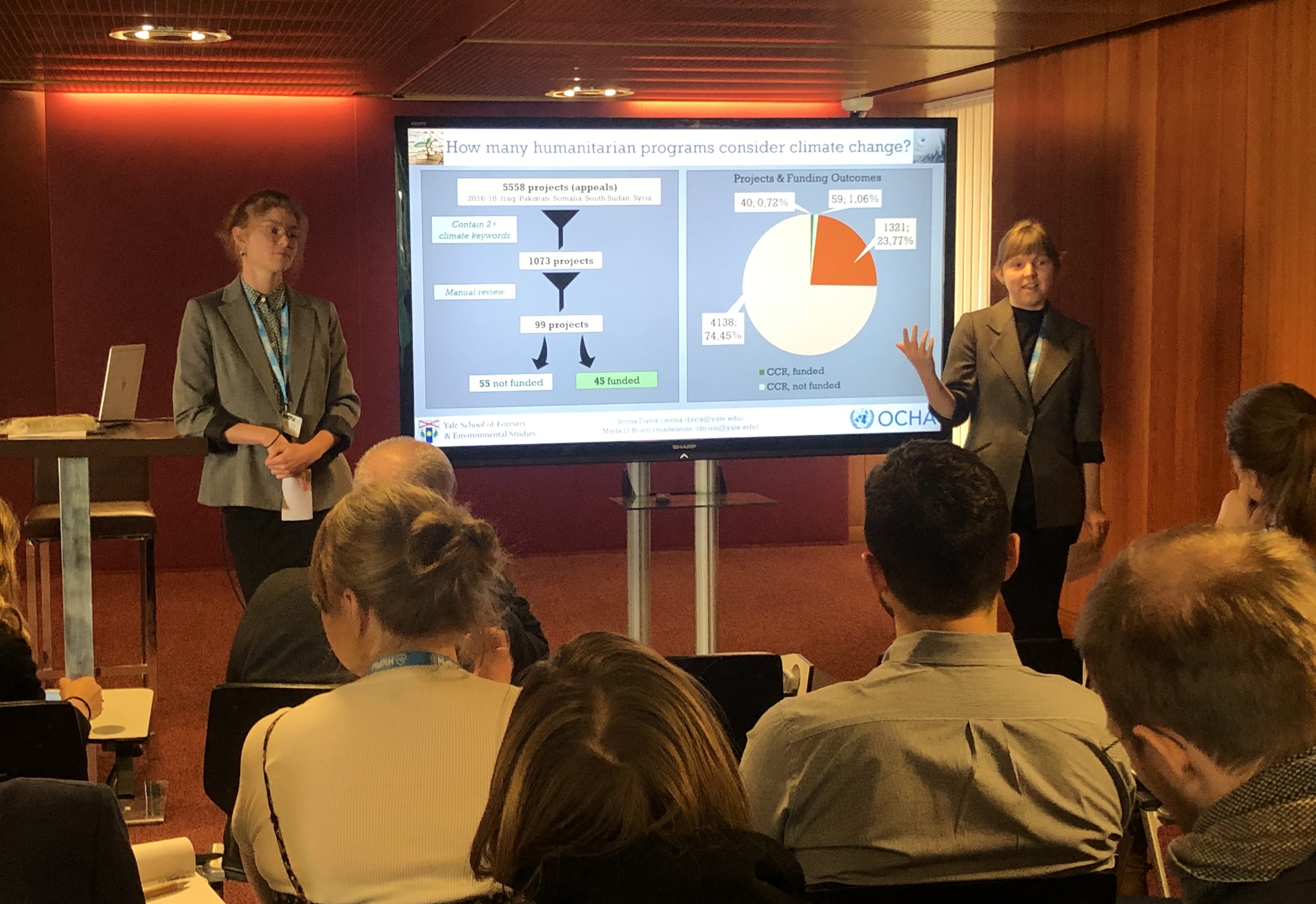
Using UN funding data, my research team attempts to answer the question, "How much money do humanitarian aid agencies spend explicitly on climate change?"
data analysishumanitarianspeakingwriting
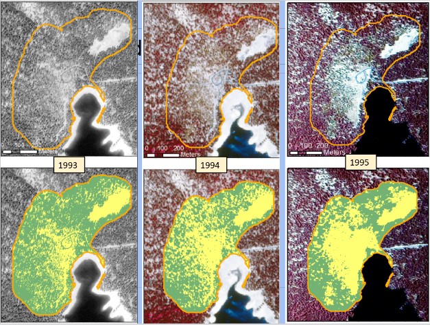
I conducted supervised image classification of aerial photos (1951-2014) to quantify deforestation on Mammoth Mountain, CA.
arcgisdata analysisgeoprocessingphotogrammetrypythonremote sensing
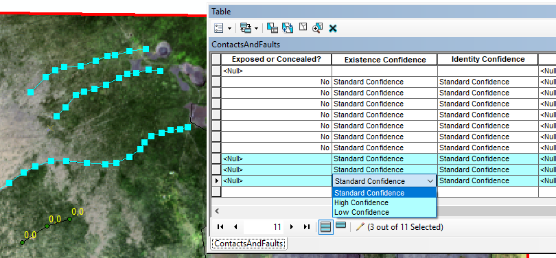
A guide for creating geologic maps using the USGS NCGMP09 cartographic standards.
arcgisearth sciencetutorialwriting
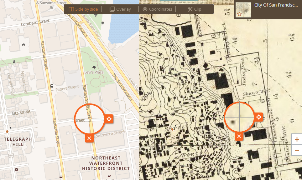
A guide teaching novices in the digital humanities how to use maps from the David Rumsey collection in web applications.
arcgis onlinegeoreferencertutorialwriting